
Flying Drones Near Huntsville Airport? Know the Rules First |
What recreational and Part 107 drone pilots in Madison need to know about approaching aircraft, controlled airspace and FAA authorization |
A Drone and Jets in the Same Sky
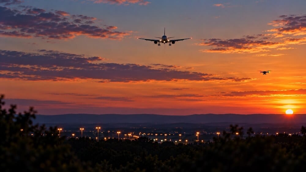
A jet descends toward Huntsville International Airport, the light is perfect and a drone camera could capture an impressive view. But that aircraft is carrying people and the airspace around its approach is not a place to improvise. Whether you fly for fun, photograph homes or hold an FAA Part 107 certificate, the same basic responsibility applies... never put a drone in the path of an aircraft.
Why Huntsville Is Different
Huntsville International Airport (HSV) has Class C controlled airspace. Just northeast sits Redstone Army Airfield, with Class D airspace and restricted airspace is nearby. Those boundaries do not follow neighborhood lines. A park, driveway or open field that feels far from the terminal may still sit beneath a protected flight path. Don't guess based on how far you are from the runway... or how low you intend to fly. Check the exact launch point, altitude and time using current FAA airspace information.
Certified or Not, Authorization Still Matters
A Part 107 Certificate qualifies someone to conduct certain drone operations; it is not a blanket permission slip for controlled airspace. Recreational flyers also need FAA authorization before flying in controlled airspace where authorization is required. LAANC, the Low Altitude Authorization and Notification Capability, allows eligible pilots to request permission through FAA-approved services. Some requests are approved quickly... others require further coordination or cannot be approved. A zero-foot grid is not an invitation to fly a few feet off the ground. Follow the authorization's location, altitude and timing limits exactly. Don't treat a manufacturer's drone app or a map screenshot as your FAA approval.
What About the 400-Foot Rule?
The familiar 400-foot figure is not a universal right to fly. Recreational flyers in uncontrolled Class G airspace generally must stay at or below 400 feet above ground level. In controlled airspace, the FAA may authorize a much lower ceiling... or none at all at your location. Even a drone below 100 feet can create a serious hazard near an aircraft's approach or departure. Always yield to crewed aircraft, maintain visual line of sight and land promptly when necessary to avoid a conflict.
Recreational Flyers: You Still Have Homework
If you're flying strictly for fun, you generally do not need a Part 107 Remote Pilot Certificate, but you must pass the free FAA Recreational UAS Safety Test (TRUST) and carry proof of completion. Follow the applicable recreational safety rules and obtain airspace authorization where required. A drone flown recreationally that weighs under 250 grams generally does not require registration; heavier recreational drones do. A lightweight drone does not get an exemption from airport airspace rules.
Part 107 Pilots: Credentials Are the Starting Point
If you're flying for business or another non-recreational purpose, Part 107 rules generally apply. That includes many paid photography jobs and some flights supporting a business even when nobody directly pays for the footage. Part 107 operations require an appropriately certificated remote pilot, registration of the aircraft regardless of weight and compliance with applicable operating rules. Controlled-airspace authorization is a separate step. Your client’s request for an aerial shot does not override an FAA restriction.
Registration, Remote ID and the Small-Drone Myth
FAA registration is required for most drones, with a narrow exception for drones under 250 grams flown only recreationally. Drones that are registered or required to be registered generally must meet Remote ID rules, subject to recognized exceptions. Remote ID broadcasts identifying and location information. Neither a small aircraft nor a compliant Remote ID broadcast makes an unsafe flight legal.
Before You Launch Near HSV
Start with FAA approved apps that help to provide situational awareness. Confirm your exact location, airspace class, altitude limit and any temporary restrictions or notices. If authorization is required, receive it before takeoff. Inspect your aircraft, assess weather and visibility, identify a safe landing area and keep your drone in sight. If a crewed aircraft approaches, give way immediately... if you cannot confidently maintain safe separation, land. Never try to film an arriving jet by placing your drone near its approach path.
FAA Approved Apps:
What If You See a Drone Near an Approaching Plane?
Don't assume every drone you see is unauthorized; lawful operations may have approval. But if a drone appears to be creating an immediate hazard to an aircraft, contact 911 and provide the location and what you observed. Don't confront a pilot in a way that creates another safety problem and don't try to interfere with or bring down the aircraft yourself.
Our Community Has Plenty to Photograph
North Alabama has tons of scenery, neighborhood events and outdoor spaces worth photographing. We can enjoy drone photography while not having to put a passenger jet at risk. The best drone pilots... certified or recreational... know when the safest flight is the one they decide not to make. |

0 Comments
Join the conversation
Be the first to comment
Share your thoughts above.